Red Flag Warning issued July 14 at 8:40AM MDT until July 14 at 9:00PM MDT by NWS Rapid City SD
...RED FLAG WARNING REMAINS IN EFFECT UNTIL 9 PM MDT THIS EVENING DUE
TO GUSTY WINDS AND LOW RELATIVE HUMIDITY FOR FALL RIVER COUNTY AREA,
NORTHERN FOOT HILLS, EASTERN FOOT HILLS, CUSTER COUNTY PLAINS, PINE
RIDGE AREA, BUTTE COUNTY AREA, PERKINS COUNTY, WEST CENTRAL PLAINS,
ZIEBACH COUNTY, HAAKON COUNTY AREA, BADLANDS AREA, NORTHERN CAMPBELL,
SOUTHERN CAMPBELL, CROOK COUNTY PLAINS, AND WESTON COUNTY PLAINS...
....RED FLAG WARNING REMAINS IN EFFECT UNTIL 9 PM MDT TUESDAY DUE TO
GUSTY WINDS AND LOW RELATIVE HUMIDITY FOR FALL RIVER COUNTY AREA,
NORTHERN FOOT HILLS, EASTERN FOOT HILLS, CUSTER COUNTY PLAINS, PINE
RIDGE AREA, BUTTE COUNTY AREA, PERKINS COUNTY, WEST CENTRAL
PLAINS,ZIEBACH COUNTY, HAAKON COUNTY AREA, NORTHEAST WYOMING PLAINS,
AND BADLANDS AREA...
* AFFECTED AREA...Fire Weather Zones 314, 315, 316, 317, 322, 323,
324, 325, 326, 327, 328, 329, 330, 331, and 332.
* TIMING...Until 9 PM MDT this evening.
* WINDS...Southeast winds 10 to 20 mph with gusts up to 35 mph.
* RELATIVE HUMIDITY...Relative Humidity between 12 to 22 percent.
* IMPACTS...Any fires that develop will spread rapidly. Outdoor
burning is not recommended.
A Red Flag Warning means that critical fire weather conditions are
either occurring now, or will shortly. A combination of strong winds,
low relative humidity, and warm temperatures can contribute to
extreme fire behavior.
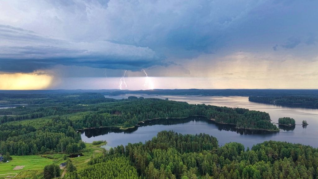
Varoitus voimassa ti klo 17:40 - ke klo 6:00